Summary
SafeRoute Campus helps students find safer, better-lit, and more accessible routes across and around campus. Users report issues at places (lighting, obstructions, harassment, accessibility) and score walking routes for safety, lighting, and accessibility. A compact schema lets us launch quickly and iterate.
Audience
- Students seeking safer paths at night or during winter weather.
- Parents/visitors needing stroller- or wheelchair-friendly routes.
- Facilities & student services prioritizing fixes based on crowd data.
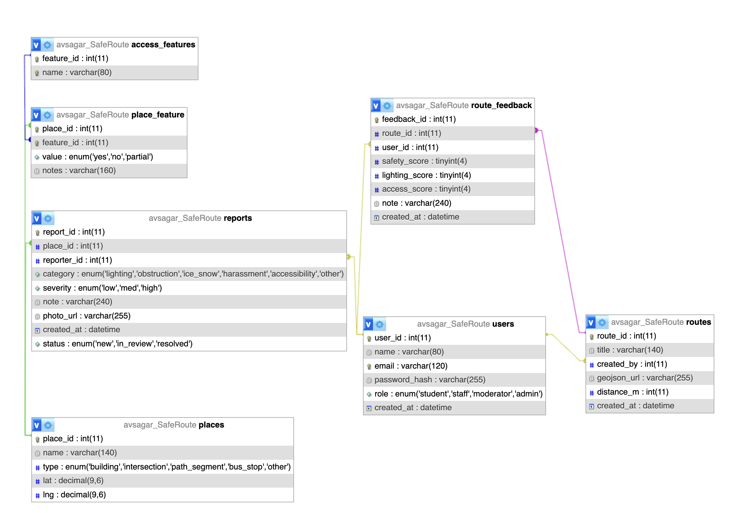
Underlying Data (Minimal Schema)
Initial Database Schema
Key Use Cases (MVP)
- Report an issue at a place with category + severity + optional photo.
- Rate a route for safety, lighting, and accessibility with a quick note.
- Browse routes and places to plan a safer trip across campus.
30–90s Pitch Video
Expansion Roadmap
- Native GIS: store polylines in DB or PostGIS; live snapping to sidewalks.
- Real-time overlays: campus advisories, lighting outage feeds, weather alerts.
- Gamified reputation: upvotes, report validation, trusted "route scouts."
- Accessibility depth: elevator outage feed, interior wayfinding.
- Events: "Safe Walks," winter safety workshops, volunteer audits.
All of these add-ons can be layered on top of the minimal schema without breaking changes.